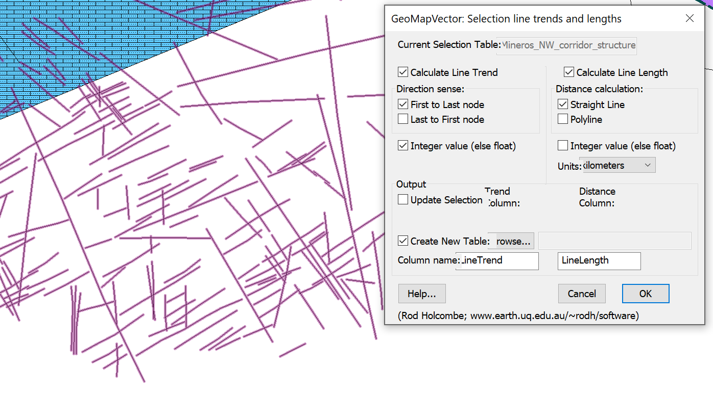
HCOVG logo
  • Software Home
    • RodHome..
  • Premium software
    • GEOrient
    • GeoCalculator
    • Purchase
    • Installation, etc
  • GIS Tools
    • GeoQSymbol for QGIS
    • GeoMapSymbol for Mapinfo
    • GeoMapVector for Mapinfo
    • PolyNodeExtractor for Mapinfo
  • Other Software
    • Strain & Shear Calculator
    • Ghoshflow
    • GeoFryPlots
    • Teaching animations...
  • Contact me
Rod Holcombe logo
  • Software Home
    • RodHome..
  • Premium software
    • GEOrient
    • GeoCalculator
    • Purchase
    • Installation, etc
  • GIS Tools
    • GeoQSymbol for QGIS
    • GeoMapSymbol for Mapinfo
    • GeoMapVector for Mapinfo
    • PolyNodeExtractor for Mapinfo
  • Other Software
    • Strain & Shear Calculator
    • Ghoshflow
    • GeoFryPlots
    • Teaching animations...
  • Contact me

GeoMapVector for Mapinfo

GeoMapVector screen image

GeoMapVector©

is a MapInfo tool that calculates the azimuth (trend, orientation) and/or the length of line or polyline objects in a MapInfo table. 
Download...
Free [~35kb]
Disclaimers...

What it does
  • GeoMapVector works on the current Selection of objects and either updates pre-existing trend and/or length columns or produces a new table with the added columns. Azimuths are calculated on the ellipsoid for Earth-based tables and in cartesian space for non-earth based tables.
  • The program is useful for capturing the orientation of digitised line data such as map strike symbols or lineation arrows, and for analysis of digitised lineament or fracture data. See BugFix history for this version.


Download
geomapvector.zip
Zip file (.zip) containing the MapInfo tool: GeoMapVector.mbx [~35 kb]


Notes
  • The software is specific to MapInfo
  © Rod Holcombe 2021         [Based on a free web site created at Weebly]